


01 Forest Hills Voting District, Greene County, Tennessee
About
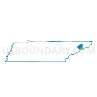
Outline

Summary
| Unique Area Identifier | 668581 |
| Name | 01 Forest Hills Voting District |
| County | Greene County |
| State | Tennessee |
| Area (square miles) | 40.75 |
| Land Area (square miles) | 40.71 |
| Water Area (square miles) | 0.04 |
| % of Land Area | 99.91 |
| % of Water Area | 0.09 |
| Latitude of the Internal Point | 36.12621050 |
| Longtitude of the Internal Point | -82.66016750 |
Maps


Graphs
Select a template below for downloading or customizing gragh for 01 Forest Hills Voting District, Greene County, Tennessee


Neighbors
Neighoring Voting District (by Name) Neighboring Voting District on the Map
- 01 South Central School Voting District, Washington County, TN
- 13 Tusculum Corp Voting District, Greene County, TN
- 13 Tusculum South Voting District, Greene County, TN
- 14 Chucky Doak Voting District, Greene County, TN
- 15 Jockey Voting District, Greene County, TN
- 18 Limestone Ruritan Voting District, Washington County, TN
- 22 Greystone Voting District, Greene County, TN
- Flag Pond Voting District, Unicoi County, TN
- Voting District LAUREL, Madison County, NC
- Love Chapel Voting District, Unicoi County, TN
- Temple Hill Voting District, Unicoi County, TN
Top 10 Neighboring County Subdivision (by Population) Neighboring County Subdivision on the Map
- District 2, Greene County, TN (10,094)
- District 8, Washington County, TN (9,728)
- District 9, Washington County, TN (9,413)
- District 3, Greene County, TN (7,075)
- District 1, Unicoi County, TN (5,727)
- Township 2, Laurel, Madison County, NC (1,100)
Top 10 Neighboring Unified School District (by Population) Neighboring Unified School District on the Map
- Washington County School District, TN (63,291)
- Greene County School District, TN (53,720)
- Madison County Schools, NC (20,764)
- Unicoi County School District, TN (18,313)
Top 10 Neighboring State Legislative District Lower Chamber (by Population) Neighboring State Legislative District Lower Chamber on the Map
- State House District 118, NC (69,261)
- State House District 6, TN (63,258)
- State House District 5, TN (59,380)
Top 10 Neighboring State Legislative District Upper Chamber (by Population) Neighboring State Legislative District Upper Chamber on the Map
- State Senate District 1, TN (185,350)
- State Senate District 3, TN (180,403)
- State Senate District 47, NC (168,288)
Top 10 Neighboring 111th Congressional District (by Population) Neighboring 111th Congressional District on the Map
Top 10 Neighboring Census Tract (by Population) Neighboring Census Tract on the Map
- Census Tract 910, Greene County, TN (7,790)
- Census Tract 619.01, Washington County, TN (6,752)
- Census Tract 909, Greene County, TN (5,215)
- Census Tract 902, Greene County, TN (3,100)
- Census Tract 801, Unicoi County, TN (2,668)
- Census Tract 101, Madison County, NC (2,546)
Top 10 Neighboring 5-Digit ZIP Code Tabulation Area (by Population) Neighboring 5-Digit ZIP Code Tabulation Area on the Map
- 37743, TN (25,588)
- 37745, TN (18,401)
- 37650, TN (12,750)
- 28753, NC (11,670)
- 37641, TN (8,567)
- 37681, TN (6,121)
- 37616, TN (4,874)
- 37657, TN (972)